Русский


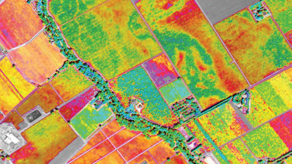

Data from remote sensing satellites for monitoring farmlands will be available to Russia’s BRICS partners, as well as to the member states of the Eurasian Economic Union (EAEU) and the Shanghai Cooperation Organization (SCO), Russian Space Systems said on Thursday (July 10).
They stated that “Data from the domestic orbital constellation of remote sensing satellites in the form of ready-made service solutions for agriculture will be available to Russia’s BRICS partners, as well as observer countries and, in the future, to the EAEU and SCO member states.”
The BRICS member states are planning to draw up a strategic plan to enhance cooperation in the agricultural sector this year.
Maxim Boltachev, of Russia’s Terra Tech (a Roscosmos subsidiary) said that “We have already proposed building the work of the new BRICS Agrarian Alliance on the Russian technological groundwork in the field of remote sensing and services based on space data and artificial intelligence.”
The parties will be able to access a single geoinformation platform, where data from satellite constellations of the participating countries will be transmitted, he said. “It will also be processed there, packaged into specialized analytical reports and digital products for users from government, scientific organizations and businesses.”
The ten BRICS full member nations possess about 46% of total global agricultural land. Satellite data plays an increasingly vital role in modern agriculture, offering valuable insights into crop health, soil conditions, and environmental factors. This data, often collected through remote sensing, helps farmers make informed decisions, optimize resource management, and improve overall farm efficiency.
Further Reading
Russia signs Strategic Satellite Agreements with Burkina Faso, Mali and Niger